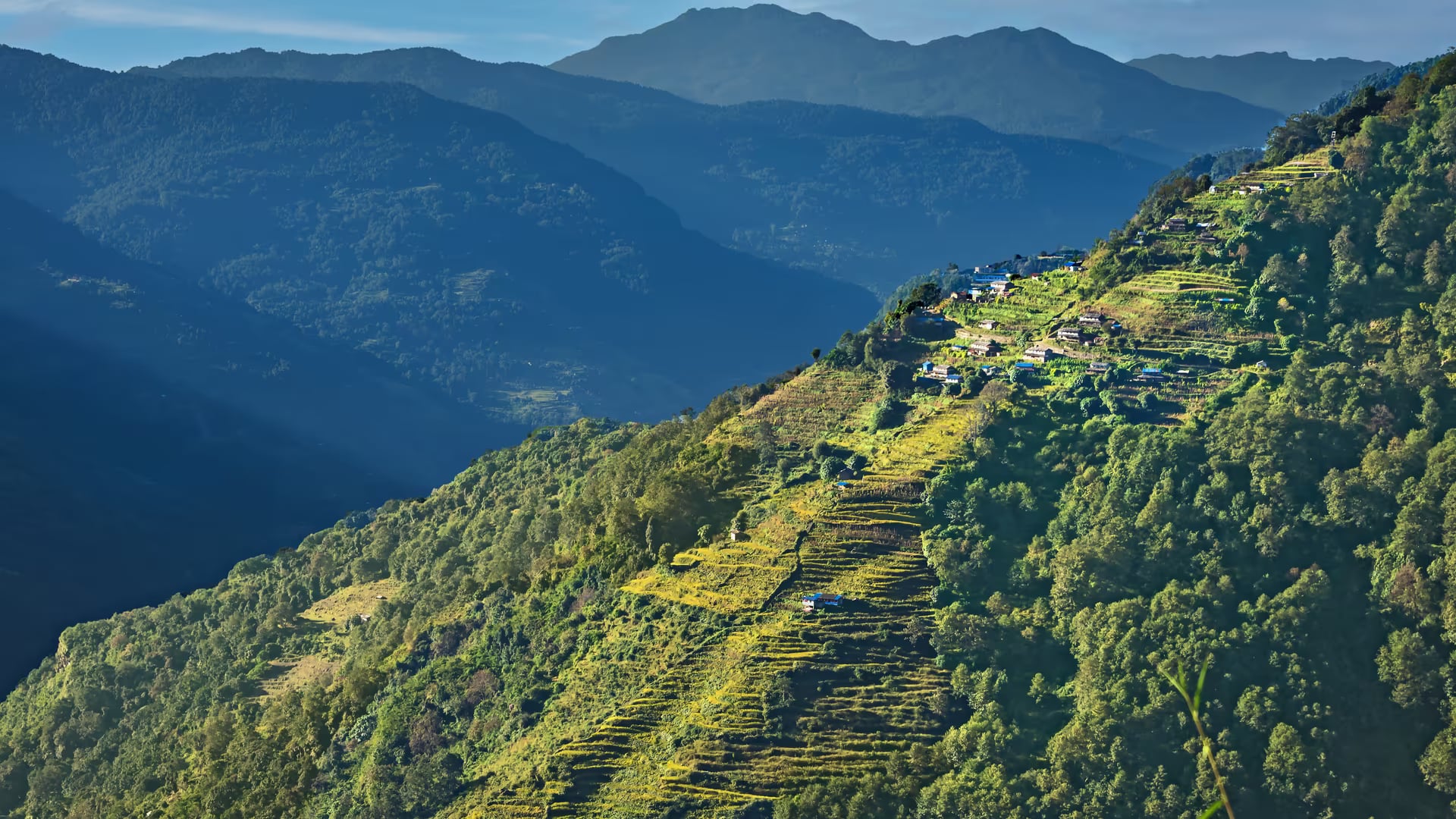
Annapurna Conservation Area
Nepal's largest protected area and first conservation area — a 7,600 km² landscape from subtropical valley to trans-Himalayan desert, home to the country's classic treks.
- Altitude
- 8,091 m
- Coordinates
- 28.600°, 83.850°
Current Weather
The Annapurna Conservation Area is the largest protected area in Nepal at 7,629 square kilometres, and the first and most influential conservation area in the country. Established in 1992 and managed by the National Trust for Nature Conservation through its Annapurna Conservation Area Project (ACAP), it pioneered a model in which local communities, rather than the army, manage the landscape and reinvest tourism revenue locally.
The area wraps around the entire Annapurna massif and spans an exceptional range of environments — subtropical forest in the south, the deep Kali Gandaki gorge, alpine pasture, and the arid trans-Himalayan valleys of Manang and Mustang in the rain shadow to the north. It shelters snow leopard, blue sheep, Himalayan tahr, musk deer and the Tibetan argali, alongside more than 470 bird species.
This is the setting for some of the most famous trekking routes on earth: the Annapurna Circuit, the Annapurna Base Camp trek, Tilicho Lake and Poon Hill. The diversity of cultures along the way — Gurung, Thakali, Manangi and the Tibetan-influenced communities of Mustang — is as much a draw as the mountains.
Pokhara is the gateway, and an ACAP permit is required for all trekking in the area. Spring and autumn are the main seasons, though the rain-shadow north of the Annapurnas remains walkable through the monsoon.
Getting there
Pokhara is the main planning and road gateway for the Annapurna Conservation Area.
- PokharaMain gateway
- NayapulAlternate gateway
- BirethantiAlternate gateway
- BesisaharAlternate gateway
- JomsomAlternate gateway
Routes to these gateways
- KathmandutoPokharaFlight0.4-0.6 hr
- KathmandutoPokharaTourist bus6-8 hr
- KathmandutoBesisaharTourist bus7-10 hr
- PheditoPokharaJeep0.75-1.25 hr
- KagbenitoJomsomJeep1-1.5 hr
- KathmandutoBesisaharJeep6-8 hr
Location & What's Inside
Connects to
Routes and trails that link here
Planning this trip? Local operators publishing trips here can arrange it.
Elsewhere in this region
Help us get it right
Know Annapurna Conservation Area better than we do?
We write from research and reporting, and the ground changes faster than we can keep up. If something here is out of date, or you have been and would tell it differently, we would rather hear it.