Chandragiri Hills
The 2,551m southwestern rim of the Kathmandu Valley above Thankot — reached in ten minutes by gondola or on foot from Godam, with Bhaleshwor Mahadev at the summit, an Annapurna-to-Everest skyline on clear winter mornings, and the ridge descent into Chitlang.
- Altitude
- 2,551 m
- Coordinates
- 27.672°, 85.208°
Current Weather
Chandragiri is the southwestern high point of the Kathmandu Valley rim at 2,551 metres, rising directly above Thankot and the Tribhuvan Highway. For most Kathmandu residents it is a half-day viewpoint trip; for weekend travellers heading over the ridge to Chitlang and Markhu, it is the divide between the capital and the farming valleys of northern Makwanpur.
Two ways up, and what is on top
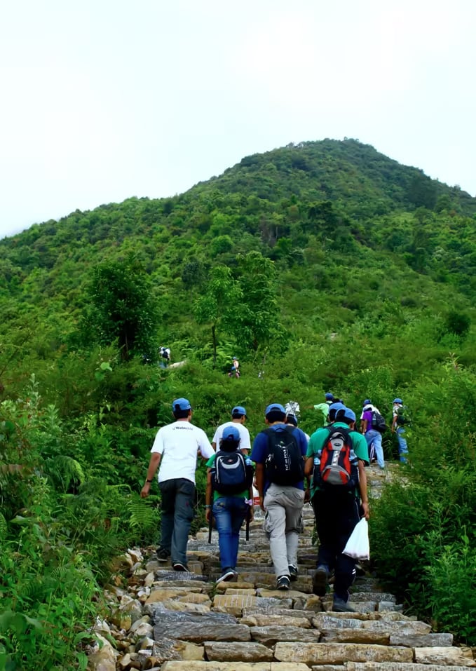
Most visitors ride the Chandragiri Cable Car from the bottom station above Thankot, a ten-minute gondola climb over pine and oak forest that replaced a half-day uphill trudge. Walkers take the Chandragiri Hills trail from Thankot or Godam instead, or ride up and walk down.
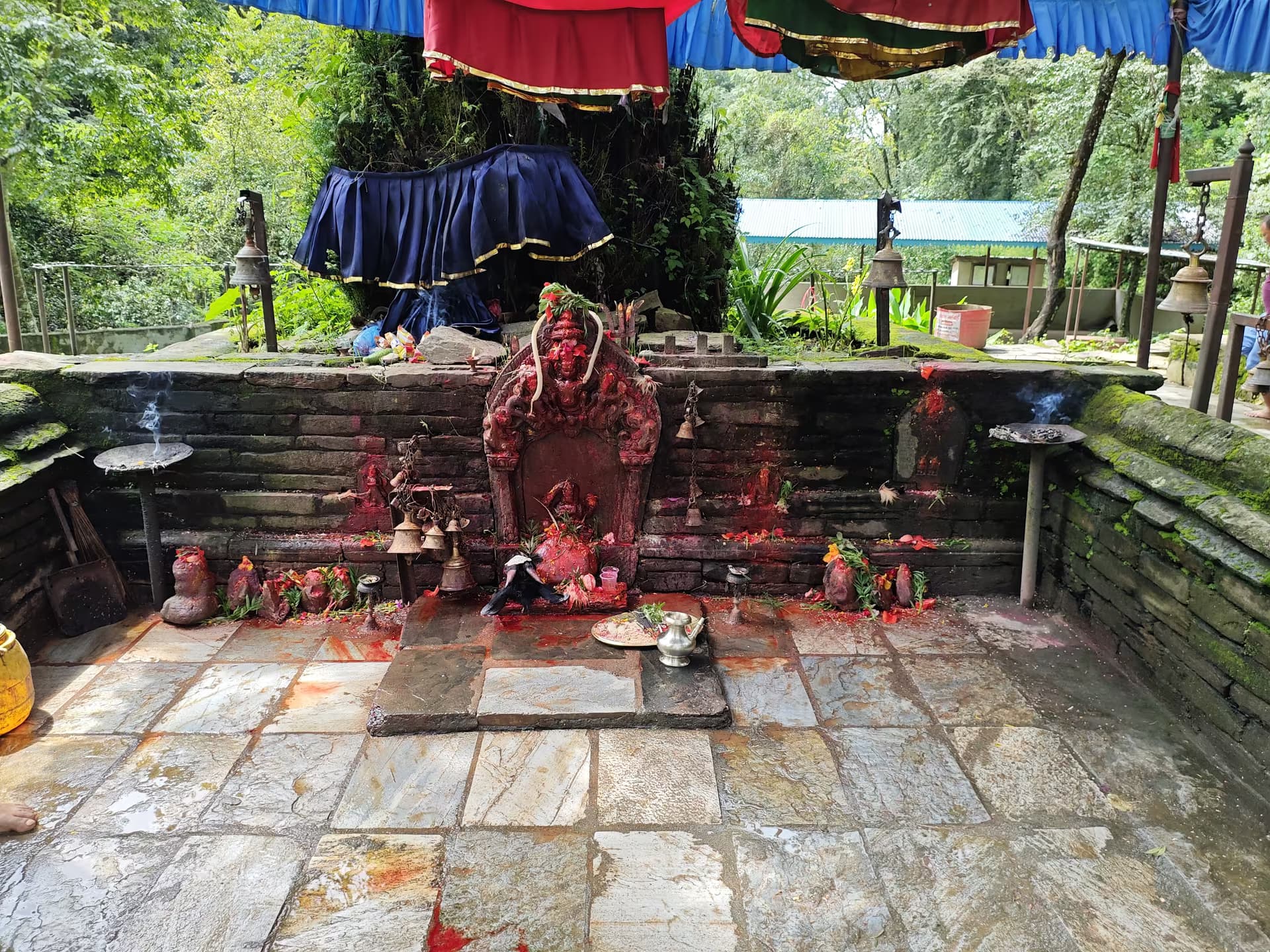
The summit ridge is a built hilltop complex centred on Bhaleshwor Mahadev, a Shiva temple tied in local tradition to Prithvi Narayan Shah's campaign before the Gorkha conquest of the valley, alongside viewing decks, restaurants, a children's play zone and a ridge-top resort. It is not a wilderness summit, and expecting a quiet forest shrine is the wrong frame.
The view, and the timing constraint
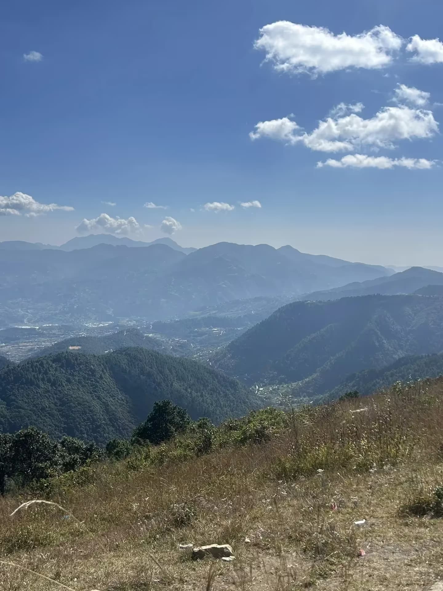
On a clear autumn or winter morning the northern horizon runs from Dhaulagiri and Annapurna across Manaslu, Ganesh Himal, Langtang, Dorje Lakpa and Gaurishankar to a distant Everest in the east, with the whole Kathmandu Valley floor laid out below. By late morning valley haze and ridge cloud frequently close that window, and on Saturdays and public holidays the cable-car queue at Thankot builds quickly. Go early.
Crossing over to Chitlang
From the summit ridge a forest path drops south off the rim into Chitlang in three to four hours. If you are travelling by road rather than walking down from the gondola, shared pickups and jeeps cross the Chandragiri pass from Godam above Thankot in the morning only.
Getting there
Local buses from Kathmandu's Old Bus Park run towards Thankot and Godam on the western edge of the valley, below the Chandragiri cable-car base station and hiking trailhead.
- GodamMain gateway
Routes to Godam
- KathmandutoGodamPublic busDuration varies
- ChitlangtoGodamJeepDuration varies
Location & What's Inside
Within this area
Places and landmarks inside
Connects to
Routes and trails that link here
Planning this trip? Local operators publishing trips here can arrange it.
Elsewhere in this region
Help us get it right
Know Chandragiri Hills better than we do?
We write from research and reporting, and the ground changes faster than we can keep up. If something here is out of date, or you have been and would tell it differently, we would rather hear it.