Markhu and Indra Sarobar
Kathmandu's one-night water trip — the Kulekhani reservoir at 1,530m, wooden boats by the hour, fried fish on the shore and a working dam at the far end.
- Altitude
- 1,530 m
- Coordinates
- 27.610°, 85.170°
Current Weather
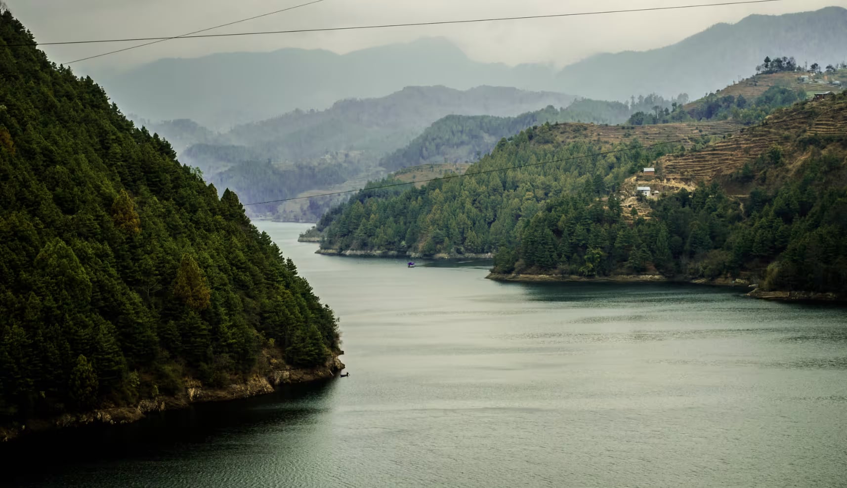
Indra Sarobar is the lake behind the Kulekhani dam, and Markhu is the village on its northwestern shore. Together they are the Kathmandu Valley's default water weekend: three hours from the city, wooden boats for hire by the hour, fried fish for lunch, and a hillside of homestays and small resorts that exist entirely because of Saturday traffic from the capital.
It is worth being clear about what it is. This is not a natural lake. The 114-metre rock-fill Kulekhani dam was built between 1977 and 1982, Nepal's only large storage hydropower scheme, and it flooded the Kulekhani valley to make a reservoir of about 85 million cubic metres across 2.2 square kilometres, held at a normal level of 1,530 metres. Knowing that explains most of what you see: the drowned terraces at the waterline, the swings in level, and the fact that the far end of the reservoir is a dam wall rather than a shore.
What people do here
Boating is the whole point. Long wooden boats with outboard motors run tours out towards the dam and the side arms, charging a few hundred rupees a head for an hour; on a weekday morning you may have the water to yourself, and on a Saturday there is a queue. Fish is the other reason people come — the reservoir is farmed, and the restaurants along the Markhu shore serve it fried or in a thali, which is what most Kathmandu day-trippers actually drive out for. Beyond that there is picnicking, some kayaking, and the ridge walks above the village.
Swimming is not really a thing here and should not be: the water is deep, cold and part of a working hydro scheme.
The honest caveats
The reservoir is drawn down for power generation and refilled by the monsoon, so the water level moves a lot through the year. Late in the dry season — April and May — the level drops and the shoreline becomes mud and stumps, which is the single most common disappointment reported here. The best-looking water is from September through December, when the reservoir is full after the monsoon and the air is clear.
The other caveat is the road. Both approaches cross steep Mahabharat hillsides and both are vulnerable in the monsoon.
Getting there
The usual route is Kathmandu to Thankot, over the Chandragiri pass, down through Chitlang and on to Markhu — about 45 km and two and a half to three hours. The alternative is the Tribhuvan Rajpath from Naubise and then the Kulekhani road, which is longer but a better surface. Local buses from Kalanki cover the first route.
Almost nobody comes here alone: the standard trip is a night in Chitlang plus a morning on the water, and Daman further west along the same ridge line makes it a two-night loop if you want one.
When to go
Autumn is the answer — full reservoir, clear air, warm days at 1,530 metres. Winter is good and quiet, with cold mornings and fog burning off the water. Spring is hazy and the water is low. The monsoon fills the lake and closes the view, and the road is the problem rather than the rain.
Location & What's Inside
Connects to
Routes and trails that link here
Planning this trip? Local operators publishing trips here can arrange it.
Elsewhere in this region
Help us get it right
Know Markhu and Indra Sarobar better than we do?
We write from research and reporting, and the ground changes faster than we can keep up. If something here is out of date, or you have been and would tell it differently, we would rather hear it.