Sailung
The “hundred hills” ridge on the Dolakha–Ramechhap border — 3,146m of open grazing pasture with Annapurna-to-Everest views and almost no crowd.
- Altitude
- 3,146 m
- Coordinates
- 27.562°, 85.974°
Current Weather
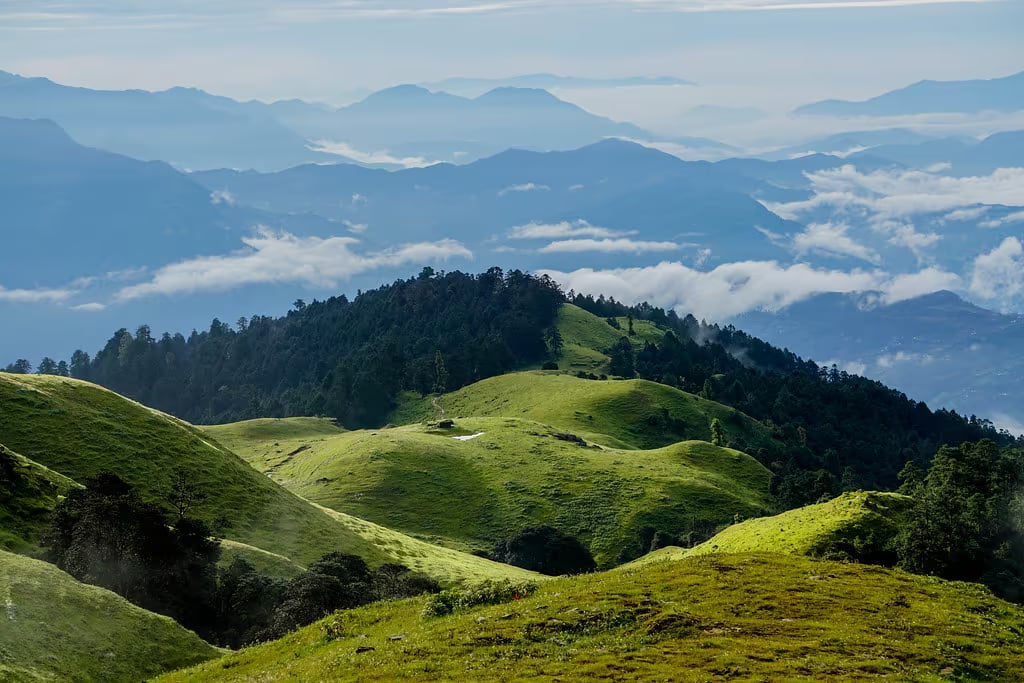
Sailung means "hundred hills" in Tamang, and standing on the 3,146-metre summit the name explains itself: the ridge falls away in every direction into an endless corrugation of green and brown hillocks, with no single valley or peak organising the view. It is one of the finest all-round panoramas in the middle hills — the Himalaya from Annapurna to Everest on the northern horizon, and the folded midlands running south toward the Terai — and until recently almost nobody outside Dolakha and Ramechhap had heard of it.
A grassland ridge, not a mountain
Sailung is a broad open grazing ridge rather than a peak, which is what makes it unusual. The summit and the slopes below it are treeless pasture, cropped short by cattle and sheep, and you can walk along the crest for hours in any direction. That openness is the whole experience: sunrise and sunset both work from the same ground, and there is nothing between you and the horizon.
The ridge sits on the boundary between Dolakha and Ramechhap, and both districts claim it. The rural municipality on the Dolakha side is named Sailung; on the Ramechhap side the approach comes through Doramba. In practice the visitor infrastructure is thin on both — a handful of homestays and a few basic lodges near the top, and camping is still common.
Thangmi and Tamang country
The hills below the ridge are home to Tamang villages and to the Thangmi (Thami), one of Nepal's smaller indigenous groups, concentrated almost entirely in Dolakha and Sindhupalchok. Sailung is a sacred landscape for both. Local tradition holds the ridge to be a Shiva site, and small shrines and stone cairns sit along the crest; the grazing pattern, the chautaras on the approach paths and the place names are all older than any tourism here.
Getting there
Sailung is a genuine overnight, not a day trip. The usual approach is from Mude, a bazaar on the Kathmandu–Charikot highway, from where a rough jeep track climbs toward the ridge; the last stretch is walked. Coming from the Ramechhap side, Doramba is the equivalent road head. Either way, expect five to seven hours from Kathmandu to the road head and then a climb on foot, and expect the jeep track to be impassable or unpleasant during the monsoon.
Because the ridge is exposed pasture with almost no shelter, weather is the deciding factor. October and November after the monsoon give the clearest and most reliable Himalayan views; December through February are colder, sometimes with light snow, and often equally clear. Spring is hazier but brings rhododendron on the lower approach. Avoid the monsoon entirely — cloud sits on the ridge, and the view that justifies the trip simply is not there.
What to bring
Warm layers, wind protection and a headtorch, whatever the season: the summit is high, open and unlit, and the whole point is to be out on it before dawn. Homestays are simple and food is dal bhat, so carry any medication or dietary needs with you. There is no reliable mobile coverage on parts of the ridge.
Sailung works well as a two- or three-day loop with Kalinchowk to the northeast, which shares the same approach road as far as Dolakha.
Location & What's Inside
Connects to
Routes and trails that link here
Related
Connected places and entries worth pairing
Planning this trip? Local operators publishing trips here can arrange it.
Elsewhere in this region
Help us get it right
Know Sailung better than we do?
We write from research and reporting, and the ground changes faster than we can keep up. If something here is out of date, or you have been and would tell it differently, we would rather hear it.