
Kalinchowk
Kathmandu's snow trip — a Dolakha ridge topping out at 3,842m, with the lodges and cable-car base at Kuri around 3,500m, Gaurishankar on the horizon and Nepal's biggest domestic winter crowd.
- Altitude
- 3,500 m
- Coordinates
- 27.747°, 86.032°
Current Weather
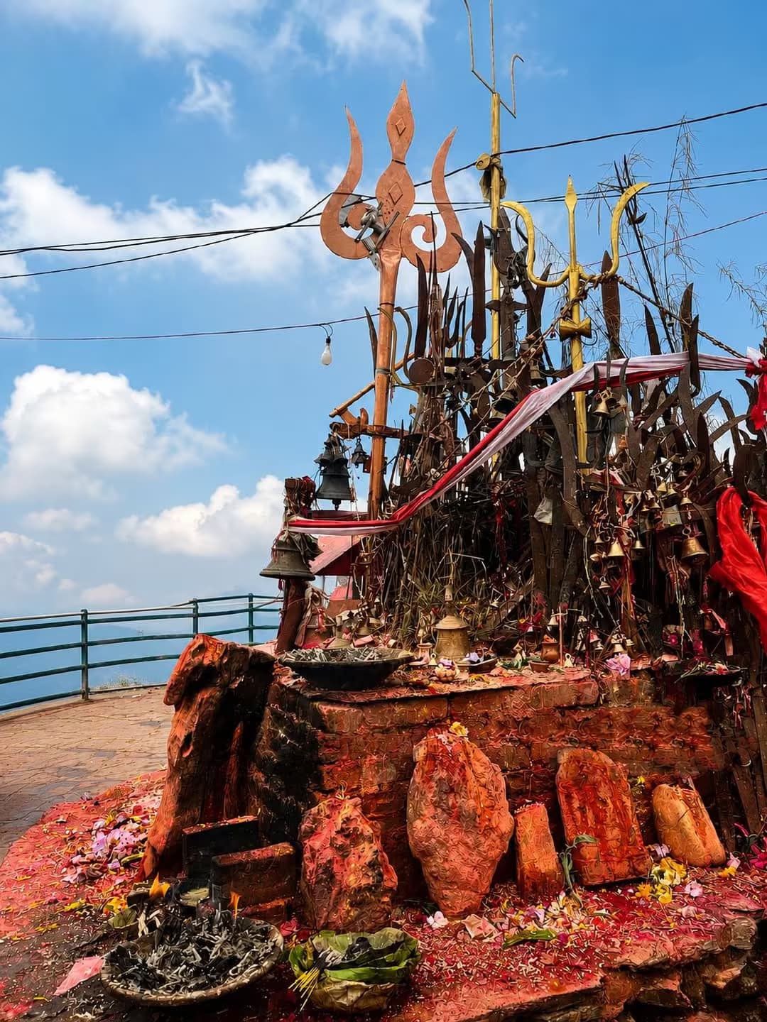
Kalinchowk is the closest thing Kathmandu has to a guaranteed snow trip. The danda rises to 3,842 metres on the western rim of Dolakha, six to eight hours from the capital by road, and from late December through February its ridge and the meadows below it are usually white. That single fact — snow, in a country where most people live below 1,500 metres and few ever see it — has turned a remote goddess shrine into one of Nepal's highest-volume domestic destinations, and filled the hamlet of Kuri at its foot with two dozen lodges that barely existed fifteen years ago.
Kuri Village and the danda
Almost every visit works the same way. You reach Charikot, Dolakha's district headquarters on the road to Jiri, then take a jeep up the rough switchbacked track to Kuri at roughly 3,500 metres. Kuri is where you sleep, eat and wait out the cold; it is a working settlement of lodges, tea shops and a cluster of Thami and Tamang households, not a resort, and the power and water both behave like what they are — high-altitude infrastructure improvised at speed.
From Kuri the shrine of Kalinchowk Bhagwati sits about a kilometre away and some 340 metres higher, on the rock at the summit. There are two ways up: a stepped walk of forty minutes to an hour, steep in places and genuinely slippery when there is ice, or the cable car, a short gondola line that lifts you to the top in about ten minutes. The cable car is the reason the demographic changed. It made the summit reachable for families with small children, for grandparents, and for anyone who was never going to do the walk — and the crowds on a January Saturday reflect that.
The view, and the honest version of it
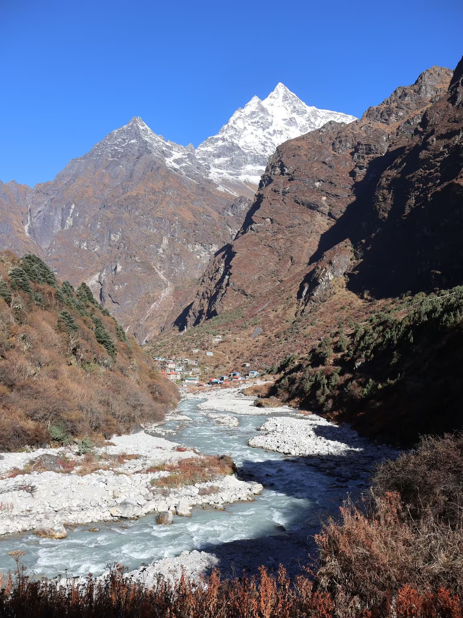
North of the summit the horizon is Rolwaling and the Gaurishankar wall: Gaurishankar itself at 7,134 metres, the ridges of the Gaurishankar Conservation Area running east toward Solukhumbu, and on a very clear morning a distant scatter of Langtang and Everest-region summits. It is a real Himalayan panorama, not a consolation one.
The honest caveats: the clear morning is not guaranteed, the summit is exposed and the wind at 3,842 metres in January is the kind that ends a visit early, and on peak weekends the queue for the cable car and the crush on the summit rock are substantial. Kalinchowk in winter is a popular place having a busy day, not a wilderness.
Snow, and when it actually falls
Snow is the draw and also the least predictable part of the trip. The reliable window is roughly late December to February, with January the safest bet; snowfall varies year to year and a warm week can strip the danda bare. Nepali social media is a better real-time source than any forecast — if there is fresh snow, the pictures will tell you within hours. Outside winter the place is quieter and quite different: pre-monsoon spring brings rhododendron on the approach and clear cold mornings, autumn after Dashain gives the sharpest long-distance views of the year, and the monsoon closes the view entirely while making the jeep track miserable.
Practicalities worth knowing before you go
Most people do this as a one-night trip — leave Kathmandu early, sleep at Kuri, walk or ride up for sunrise, return the same day. Doing it as a single day trip from Kathmandu is possible but means twelve or more hours of driving for perhaps an hour at the top; it is not recommended in winter, when the track can ice over.
Bring more warm clothing than you think you need. Kuri is above 3,500 metres, lodge rooms are unheated, and visitors underdressed for the altitude are the single most common problem here. Shoes with grip matter more than anything else you pack. Altitude is worth a thought too — the drive gains a great deal of height quickly, and mild headaches at Kuri are common even among people who have trekked before.
Kalinchowk pairs naturally with Sailung to the southwest for a longer Dolakha loop, and the road passes within reach of the Bhotekoshi bungee on the Araniko side if you approach from that direction.
Pilgrimage context
Sacred timing and nearby worship
Getting there
Charikot, the Dolakha district headquarters, is the road head for Kalinchowk; the final climb to the Bhagwati temple continues locally from there.
- DolakhaMain gateway
Routes to Dolakha
- KathmandutoDolakhaPrivate car5-7 hr
Location & What's Inside
Connects to
Routes and trails that link here
Planning this trip? Local operators publishing trips here can arrange it.
Elsewhere in this region
Help us get it right
Know Kalinchowk better than we do?
We write from research and reporting, and the ground changes faster than we can keep up. If something here is out of date, or you have been and would tell it differently, we would rather hear it.