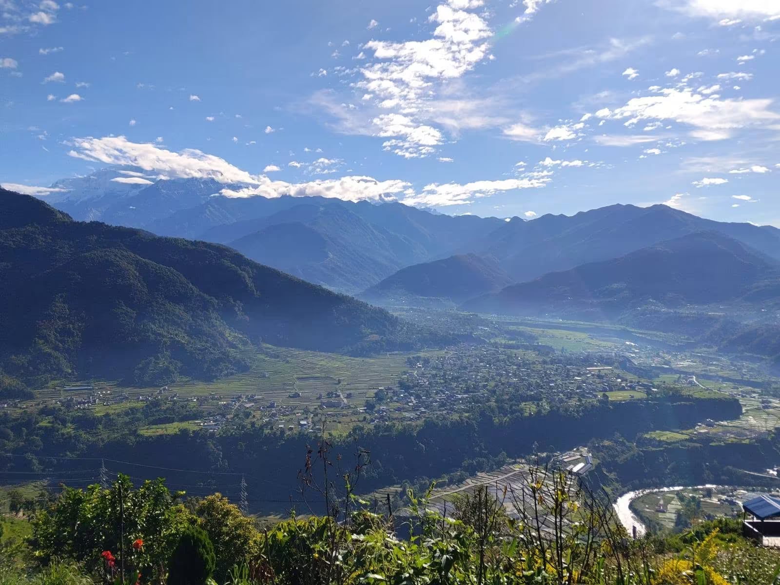
Astam
A quiet ridge village about 20km north-west of Pokhara, known for eco-lodges and homestays and for a wide, unobstructed sunrise view of the Annapurnas above the valley haze.
- Altitude
- 1,500 m
- Coordinates
- 28.299°, 83.908°
Current Weather
Astam is a small farming village strung along a ridge in Machhapuchchhre Rural Municipality, roughly 20 kilometres north-west of Pokhara and about 1,500 metres above sea level. It is not a trekking waypoint and has no bazaar — the reason to come is the view and the quiet. The ridge looks straight north across terraced fields to Annapurna South (7,219m), Machhapuchchhre/Fishtail (6,993m), and Annapurna III and IV, with the Pokhara valley falling away behind.
The village made its name through community eco-lodges and homestays — small family-run properties built in traditional style, several of them running biogas, kitchen gardens, and their own dairy. Guests eat with the household, and the usual programme is a short walk through the surrounding villages in the afternoon, dinner, and an early start for sunrise on the ridge. It is a common first or last night for visitors who want a village stay without committing to a trek.
Astam is reached by road from Pokhara via Hemja, a drive of roughly 90 minutes on a road that is rough in its upper section and best attempted in a jeep during and after monsoon. Walkers can also come up on foot from Kaskikot or continue on toward Dhampus and Australian Camp — Astam sits below and east of that ridge line, outside the Annapurna Conservation Area, so no trekking permit is needed to stay here.
Getting there
Use Pokhara as the nearest configured transport hub, then continue locally to Astam.
- PokharaNearest configured hub
Routes to Pokhara
- JomsomtoPokharaFlight0.33-0.5 hr
- KathmandutoPokharaFlight0.4-0.6 hr
- KathmandutoPokharaTourist bus6-8 hr
- PheditoPokharaJeep0.75-1.25 hr
- NayapultoPokharaJeep1.5-2.5 hr
- BirethantitoPokharaJeep1.5-2.5 hr
Pokhara is the nearest transport hub we have route data for, not a verified gateway for Astam. The final stretch is local and we have not confirmed it.
Location
Planning this trip? Local operators publishing trips here can arrange it.
Elsewhere in this region
Help us get it right
Know Astam better than we do?
We write from research and reporting, and the ground changes faster than we can keep up. If something here is out of date, or you have been and would tell it differently, we would rather hear it.